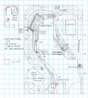
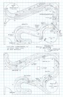
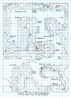
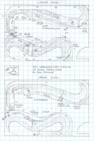
SOU L&N Clear Fork Branch track plan HO
- Size: 12′ x 16 ′
- Scale: HO
- Minimum Radius: 24″
- Minimum Aisle Width: 30″
- Designed by Dan Bourque
 The Clear Fork Branch on the border of Tennessee and Kentucky branched from the L&N’s mainline but was owned by the Southern Railway and jointly served by both roads. The Southern reached it via trackage rights from a connection to it’s Jellico line a couple miles north of the branch. The branch was several miles long, but most of the loaders were stacked in the last half of the branch between Clairfield, TN and Fonde, KY.
The Layout
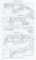
This track plan captures the Clear Fork Branch from Clairfield to Fonde … Read more
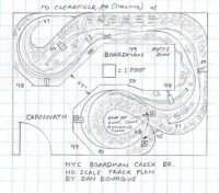
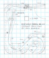
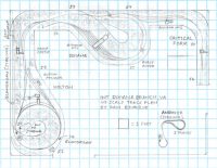
 The lines around Clarksburg, WV were home to many of the coal loaders served by the B&O including the short Lost Creek Branch. This branch left the B&O’s old West Virginia & Pittsburgh line between Clarksburg and Weston, WV at the small town of Lost Creek and traveled about 2 miles up Lost Creek to serve a pair of large tipples near Rider (“Righter” in old B&O mine listings).